

Introducing the Mountain Directory Ebooks!
CLICK HERE FOR FULL DETAILS
Travel with safety from knowledge and information about navigating through the Mountain Grades and Terrain.
VITAL INFORMATION FOR ANYONE DRIVING A LARGE OR HEAVY VEHICLE
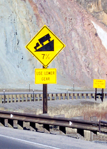
In an attempt to make mountain driving a little safer for truckers and RV’ers, R&R Publishing Inc. has been collecting and 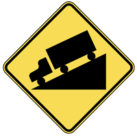 publishing information about mountain passes and steep grades since 1993. The Mountain Directory Ebooks give the locations and descriptions of over 700 mountain passes and steep grades in 22 states. The Mountain Directory ebooks tell you where the steep grades are, how long they are, how steep (%) they are, whether the road is two lanes, three-lane, or four-lane if there are escape ramps, switchbacks, sharp curves, speed limits, etc.
Check your Engine
With this information, one can know ahead of time what a pass is like and make an informed decision about whether to go over or around. If you decide to go over, perhaps the cool morning hours would ease the strain on the engine and transmission during the climb. Unhooking the towed vehicle would make the climb and the descent easier. Knowing what lies ahead is half the battle.
The printed versions of the Mountain Directory books had almost 240 pages of text and color relief maps. All 240 pages are in the downloadable versions of the Mountain Directory ebooks. Nothing is missing. In the printed versions, mountain pass locations were marked with a yellow triangle on the color relief maps. In the ebook versions, you can click on the yellow triangles and the text appears that describes that location.
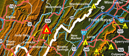 4. US 33 (between Harrisonburg, VA and Judy Gap, WV.)
Know before you Go
There are three summits along this stretch of US 33. The eastern summit is between Rawley Springs, VA, and Brandywine, WV. The east side is 4 miles of 8 to 9% grade. The west side is4½ miles of 9% grade and both sides have continuous sharp curves and hairpin turns. The highway is two lanes on both sides.
The middle summit is between Oak Flat and Franklin, WV. The east side of this hill is 2½ miles of 8% with 25 mph curves. The west side is about 3½ miles of much milder grade. It is 4 to 5% over most of its length. There are some sharp curves near the bottom. The road is two lanes on both sides of the hill.
The Western Summit
The western summit is between Franklin and Judy Gap, WV. It is 5 miles of steady 9% grade on both sides. Both sides are two lanes with sharp curves and hairpin turns. Use caution on this road.
 During the last few years, we have heard many stories about very expensive repairs to drive train components. Sometimes rigs are lost entirely. A highway patrol officer in Oregon told us that in the summer an average of one motorhome per week burns to the ground while trying to climb Cabbage Hill on I-84 east of Pendleton. If a fire starts, the nearest fire department is likely to be many miles away. By the time they arrive, there is nothing left to do but hose down the ashes.
Many people are under the impression that the grades in the eastern mountains are not as serious as the grades in the western mountains. Apparently, this is because the elevations are not as high in the eastern states.
Elevations
But elevation alone is not the problem–it is the change in elevation that makes a grade potentially hazardous. If all other factors are equal, a grade that descends from 4000′ to 1000′ over 10 miles is no different than a grade that descends from 10000′ to 7000′ over 10 miles. Either way, you have a 3000′ change in elevation spread over 10 miles. (This example would result in an average grade of almost 6% for 10 miles.)
While every effort has been made to ensure the accuracy of the maps included in this book, it is nearly impossible to include all necessary detail on such small maps. We recommend that these maps be used in conjunction with larger, more detailed road maps.
 The purpose of this book is not to discourage drivers from going where they please. It is only to inform them of the conditions they may encounter and to encourage them to make sure their equipment is in good repair.
Brakes must be in good working order and properly adjusted and the engine and transmission should be used to slow the vehicle whenever possible, thus saving the brakes and keeping them cool enough to retain their stopping power.
Cooling System
The engine’s cooling system should be in good repair to prevent overheating during the climbs. Turning off the air conditioner during climbs may help, and if necessary, turning on the heater will help dissipate heat from the engine.
There are many aftermarket devices that can help heavy vehicles in the mountains. Some will help by increasing horsepower for the climbs. These include turbos and exhaust systems. Other devices, such as engine braking systems can help during the descents. Some products, like gear splitters and auxiliary transmissions, can help during the climbs and the descents.
Many of these products also improve fuel economy (while delivering more horsepower) and reduce wear and tear on the drive train.
The main ingredients involved in overheated brakes are the length of the grade, the steepness of the grade, and the speed and weight of the vehicle. Reducing any of these will improve the chances of getting down the mountain without overheating the brakes. Most of the time, the only one the driver can change is speed. Reducing speed may keep you alive. Remember the old phrase, “You can go down a mountain a thousand times too slowly, but only once too fast.”
Try before you buy!
Check out this free demo and see how it works.
![]()
